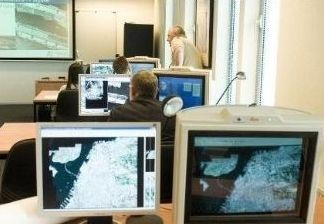
Aerial photo interpretation training

Basic interpretation course
The course includes all of the VISINT subjects and is tailored to the customer's abilities and demands.
The course is taught by professional instructors and can be executed at the client's facilities or in Rontal's offices in Israel.
The course is built of three stages:
- Introduction and mission planning.
- Mapping, cartography, geodesy and sensors.
- Interpretation foundation.
The course duration is 2-10 weeks tailored to the customer's needs and includes frontal lectures, professional tours, exercises and exams.
Advanced interpretation course
The advanced interpretation course is a continuation to the basic interpretation course and is intended for interpreters with experience and basic knowledge. The course's purpose is to deepen the knowledge and experience in the field of special interpretation in according to the customer's demands.
The course duration is 2-7 weeks tailored to the customer's needs and includes frontal lectures, exercises and exams.
During the course the trainees go through theoretical lectures in the fields of interpretation as demanded by the customer, but also and mainly have many exercises and gain much professional experience in the demanded fields of interpretation.
IR and SAR interpretation course
The courses are based on previous abilities of the interpreters in the visible light range. It includes theoretical lectures in the fields relevant to IR and SAR interpretation, and practice of interpretation of this kind, as opposed to interpretation in the visible light range.
Each course is about Two weeks long (80 hours). The two courses can be executed separated or as one package (160 hours).
The course principles:
- A visual demonstration of IR and SAR images use, possible operational products, advantages and limitations.
- Visual demonstration and guidance of the different interpretation "elements" and components of IR and SAR,
- Comparison of images from the visible light range and the IR/SAR, using products of currently existing sensors, while incrementally switching to IR and SAR interpretation only in all of the fields of interpretation.
Mapping and Geodesy course
The mapping and geodesy course gives the students the basis and the knowledge required for intelligence experts in the fields of mapping and geodesy, as well as the use of the most advanced tools in this field.
The course includes introduction lectures on the subjects of intelligence and VISINT, lectures and exercises on of mapping, cartography, geodesy and principles of different sensors in the VISINT field.
The course is taught by the Rontal's experts and is about two weeks long.
Intelligence Aids course
The Photography and Observation Systems Course is designed to give theoretical and practical knowledge about the photography and observation systems used for VISINT. The course can be taught to anybody who wishes and is about a week long, according to the client’s demand, the demanded depth and the client’s unique systems.
The course includes lectures on the following subjects:
- An Introduction to intelligence in general and specifically VISINT.
- Mission planning
- Types of existing sensors and their products.
- Demonstrations and exercises on the various interpretation subjects.